DIR Logo

An Online Encyclopedia of Roman Rulers and their Families

The DIR and ORB Ancient and Medieval Atlas

Christos Nüssli


City Maps

Note:In order to return to this page after viewing the maps of the various cities in the city atlas, hit the back space on your browser!

Rome

Rome and Its Seven Hills

Constantinople

Topographical Maps of Selected Portions of the Ancient World

Note: The IAM Maps seem to work only with version 4.0 or greater of the Netscape Browser.

Selected Maps of the Interactive Ancient Mediterranean Project

Maps of the Roman Empire

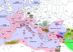
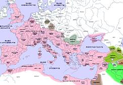
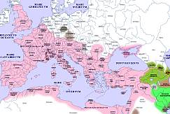
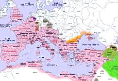
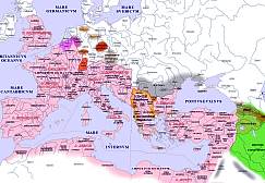
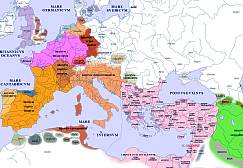
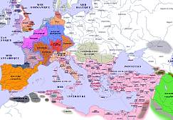
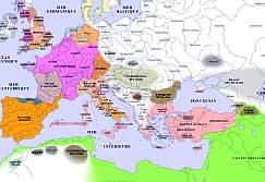
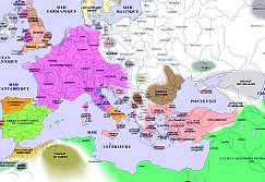
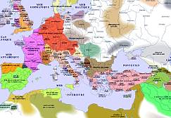
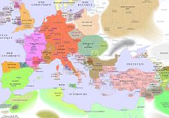
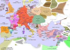
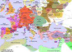
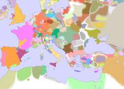
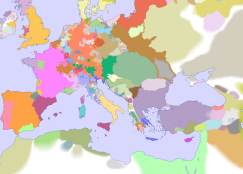
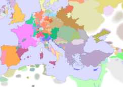
The maps in this Antique and Medieval Atlas show the political status of Europe, Africa, and Asia at the beginning of each century from the First Century to the Fifteenth Century. If your web-connection is fast, you may choose to view the full-sized maps. If not, you can click on those parts of the maps below which you want to enlarge.

Map Legend

Cartographical Bibliography


Europe 001 AD
 Clickable Image N-O/N-WS-O/S-WN-ES-E

Europe 100 AD
 Clickable Image N-O/N-WS-O/S-WN-ES-E

Europe 200 AD
 Clickable Image N-O/N-WS-O/S-WN-ES-E

Europe 300 AD
 Clickable Image N-O/N-WN-ES-O/S-WS-E

Europe 400 AD
 Clickable Image N-O/N-WS-O/S-WN-ES-E

Europe 500 AD
 Clickable Image N-O/N-WS-O/S-WS-EN-E

Europe 600 AD
 Clickable Image N-O/N-WS-O/S-WN-ES-E

Europe 700 AD
 Clickable Image N-O/N-WS-O/S-WN-ES-E

Europe 800 AD
 Clickable Image N-O/N-WN-ES-O/S-WS-E

Europe 900 AD
 Clickable Image N-O/N-WS-ES-O/S-WN-E

Europe 1000 AD
 Clickable Image N-O/N-WS-ES-O/S-WN-E

Europe 1100 AD
 Clickable Image N-O/N-WS-ES-O/S-WN-E

Europe 1200 AD
 Clickable Image N-O/N-WS-ES-O/S-WN-E

Europe 1300 AD
 Clickable Image N-O/N-WS-ES-O/S-WN-E

Europe 1400 AD
 Clickable Image N-O/N-WS-ES-O/S-WN-E

Europe 1500 AD
 Clickable Image N-O/N-WS-ES-O/S-WN-E

These maps do not pretend to be absolutely accurate. It is important to notice that, during late antiquity and early middle age, "public power" and "boundaries" were not clear notions. Moreover our knowledge are often insufficient. Thus, many borders are blurred and the white areas show "unknown territories". Grey shades or grey-like shades point out nations where public power is unknown or imprecise. 

Return to De Imperatoribus Romanis


Copyright (C) 1999, Christos Nüssli. This file may be copied on the condition that the entire contents,including the header and this copyright notice, remain intact.